Today is our last day of exploring national and state parks. We wanted to get an early start and then be able to get back to camp early. That didn't happen. There was just too much to see.
 |
| When we first drove into Moab, we saw a pedestrian bridge across the Colorado River. We wanted to cross that bridge so that was the first place we headed this morning. Actually, not only walkers use the bridge but also bicycles. |
 |
| The sun was just coming up over the top of the canyon wall. |
 |
| Access to the pedestrian bridge is through this tunnel under the highway. |
 |
| We decided to drive the highway that goes through the Colorado River Gorge. The following few pictures were taken as we drove through the gorge. |
 |
| There were a couple of ranch/resorts in the gorge. |
 |
| This picture was taken as we began the highway to Canyonlands National Park. These buttes are Monitor and Merrimac named after Civil War Ironclads. The largest on the left is named after the Confederate Ironclad the Merrimac. The smaller one on the right is named after the Union Ironclad the Monitor. |
 |
| Someone went crazy with stacking rocks to indicate trails |
 |
| These blue pools are Solar Evaporation Ponds. Potassium Chloride is harvested from these pools which is used in plant fertilizer. |
 |
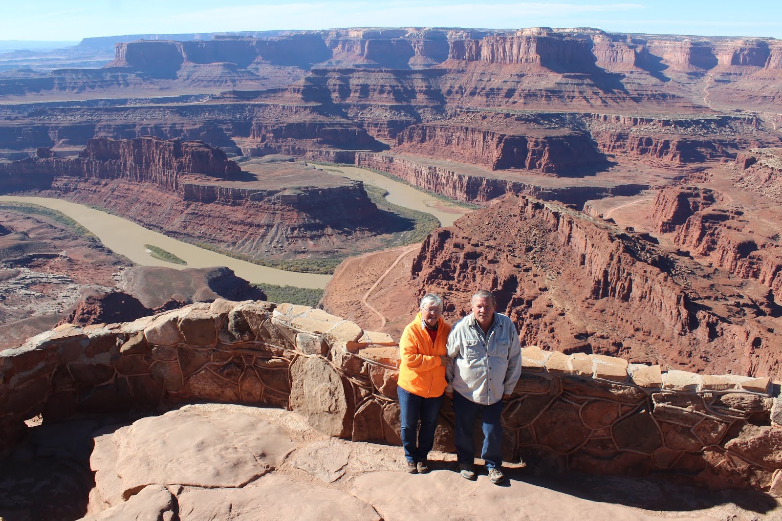
| This is Dead Horse Point. The Colorado River flows 2,000 feet below this mesa. According to legend, this mesa top served as a natural corral with tall vertical cliffs on every side but one. |
 |
| This is Aztec Mesa. |
 |
| This is Mesa Arch. When you first see the arch, you don't realize how spectacular it is. When you get close to the arch, you realize that when you look through the arch, there is the most amazing view of the canyons. |
 |
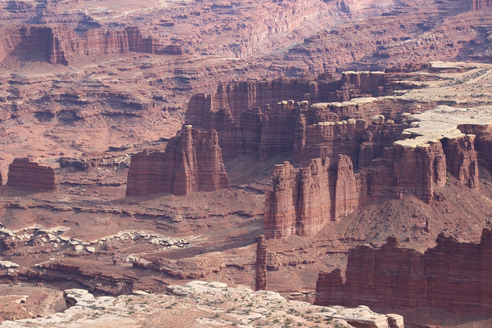
| There is a road that is 100 miles long and goes through the heart of Canyonlands many canyons. It takes 2 days to drive the 100 miles. You must have a four-wheel drive vehicle and have a permit from the National Park Service to take this road. It would be a awesome drive. |
 |
| Another view of the road in the canyon. |
 |
| This is called Candlestick Tower. |
 |
There are two separate sections in the park. The one we visited is called "Island in the Sky." The other section is called "The Needles." We didn't have time to drive to the other section. In Island in the Sky there is one major paved road. Access to the park is is mostly by hiking, bicycling, off-road vehicles, and four-wheel drive vehicles. It is a beautiful park with views that drop your jaw. If we ever get back here, we would like to visit the Needles section.
We got back to camp around 5:00. After walking Sandy, we loaded the car because we will be heading out tomorrow morning for four days of driving until we reach Springfield, Missouri. We won't be unloading the car until we reach Springfield. We don't look forward to these last four days. It is sad that our trip is nearly over. We actually have one more week until we get home November 11. |


No comments:
Post a Comment