After a good night's rest we awoke to fog in the campground.
 |
| Our first stop was an overlook in the park. Instead of seeing the Mississippi River, we saw more fog! |
 |
| Spider webs fascinate me. |
 |
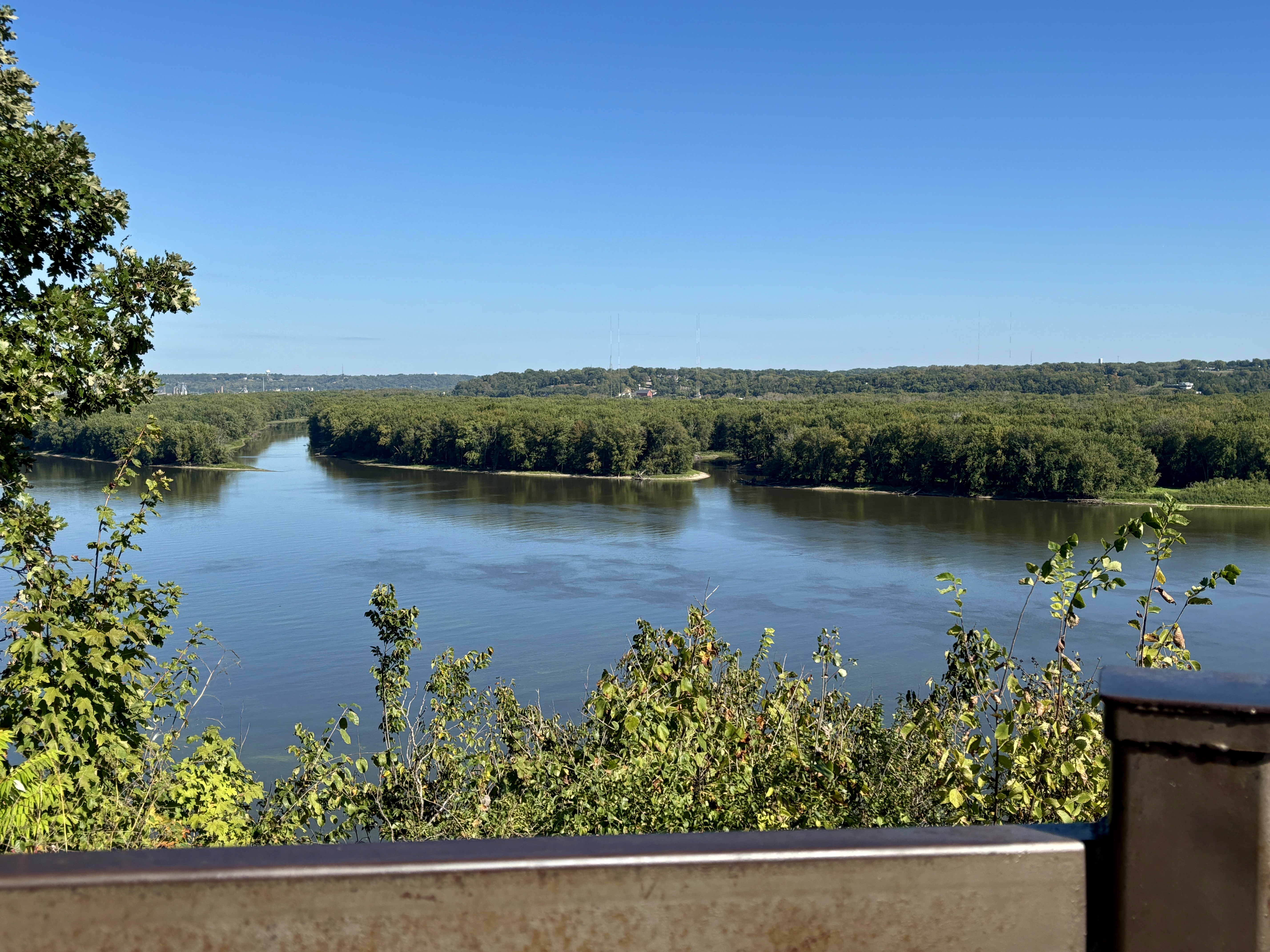
| The Mississippi River is below. |
 |
| Because of the fog we couldn't see the river so we drove to Effigy Mounds |
National Monument. To get to the park, we drove through MacGregor. Above and below are pictures of main street. There are all kinds of neat shops. Maybe next time around, we can stop but today we were on a mission to see Effigy Mounds .
 |
| The road had limestone bluffs on one side and the Mississippi River on the other side. |
 |
| The Mounds is celebrating 75 years as a National Monument. I had to admit to the ranger that I had never heard of this park until the Iowa Quarter came out with the Mounds pictured on it. She said she has heard that so many times. There are three kinds of mounds preserved in the park: effigy, conical, and linear. The conical and linear were probably places of burial. The effigy mounds of animals were probably clan symbols used in seasonal ceremonies. It is estimated that in the 1800's there were over 10,000 mounds of all types; however, fewer than 1000 survive today. |
 |
| We took one trail which was on a boardwalk. This tunnel goes under the highway. |
 |
| Along the trail were a couple of linear mounds and a conical mound. |
 |
| Most of the trails to see the effigy mounds were at least two miles long. We started on one but the first part of the trail was mostly up so we decided to save it for another time (maybe?) |
 |
| This and several pictures following were taken along the boardwalk trail. |
 |
| After we left Mounds, we drove across this bridge over the Mississippi to Wisconsin and the town of Prairie du Chien. |
 |
| We stopped at the Welcome Center for suggestions of what to see and do in Prairie du Chien. We decided to eat lunch first before visiting the site of an old fort. |
 |
This is where we had lunch. It was very good. Carol had fried chicken and I had a chicken/bacon wrap. Both were very good.
From there we drove to the site of Fort Crawford. Fort Crawford was actually built two times. The first time was in 1816 on St. Feriole Island right on the Mississippi River. It was built out of wood and the wood deteriorated very quickly due to heavy moisture. The second fort was built higher on the bluff of limestone and survived until the Army closed the fort The fort was built to help control the Plains Indians and protect European settlers moving into the area. The commander of the second Fort Crawford was Col. Zachary Taylor (future president). Also on the post was Jefferson Davis (future president of the Confederacy). In fact, Jefferson Davis married Zachary Taylor's daughter.
The only building which survived is the hospital. Today this building houses a medical museum. The doctor of the fort Dr. William Beaumont became well known for his medical experiments concerning the digestive system. He had a patient who had a gunshot wound in his stomach that would not heal. He called the hole "his lid to the stomach" and performed 56 experiments on the patient. I guess you could say that this bad thing resulted in good things! |
 |
| This island in the east channel of the Mississippi was once a big fur trading hub for the Upper Mississippi River until over hunting ended the trade. One fur trader became a land speculator and during his lifetime became Wisconsin's first millionaire. His name was Hercules Louis Dousman. He was quite a character and scallywag. |
 |
| His first house. |
 |
| After his death, his wife and son built this grand house called Villa Louis. Tours are offered on the hour but we couldn't catch the tour at the right time and didn't want to wait around so again next time (maybe?). |
 |
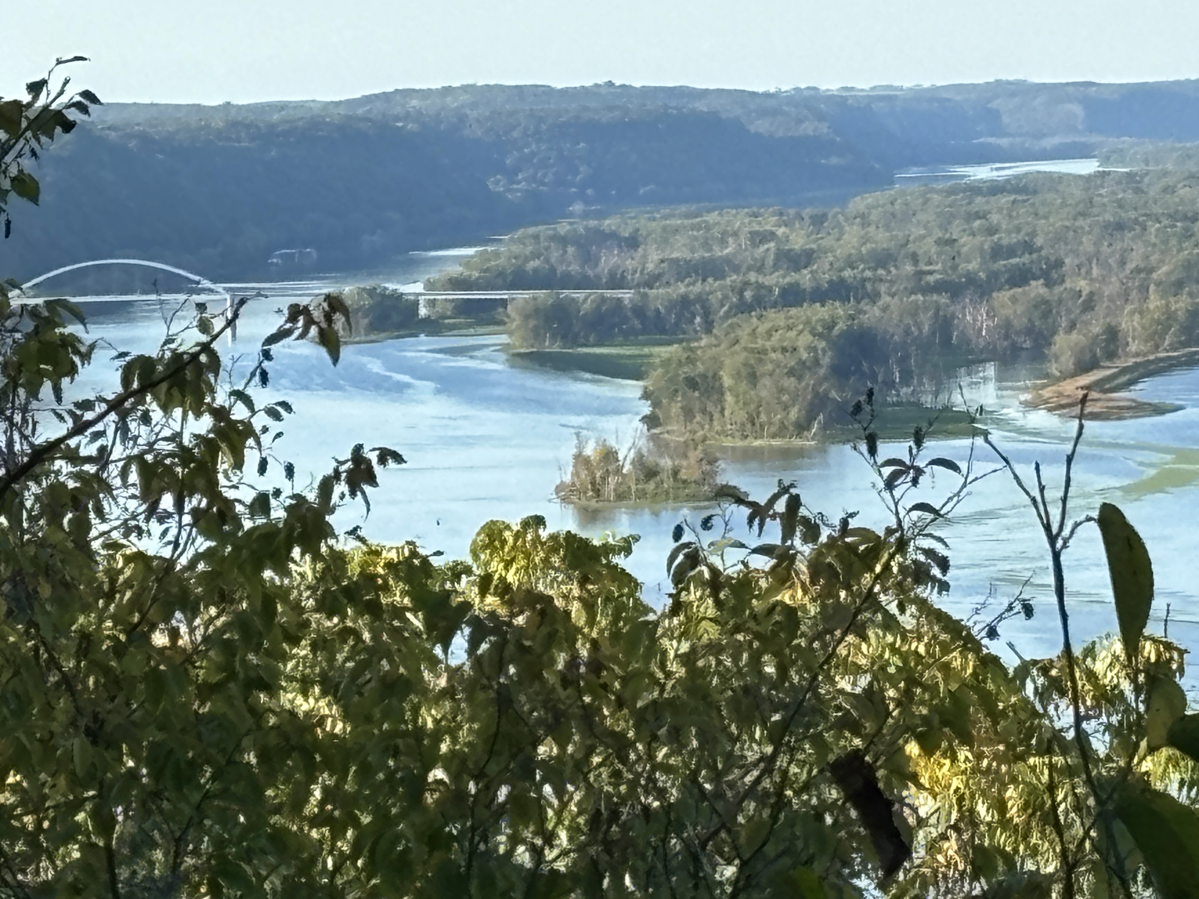
| About three o'clock we drove back to our camp site to relax. About 5:30 we drove back to the first overlook we were at this morning to take pictures that we missed because of the fog. This picture shows the confluence of the Wisconsin River and Mississippi. In the middle of the picture there is a railroad bridge going over water. That is the mouth of Wisconsin River flowing into the Mississippi. |
 |
| This picture shows the bridge we crossed into Wisconsin and Prairie du Chien. |
 |
| After we took the above pictures, we decided to take the trail to Bridal Falls. This is Bridal Falls. The water level limited the falls to no more than a trickle but the hike into the canyon was very nice. The trail was all boardwalk and stairs. By the time we finished this hike, we had hiked four miles for the day. Hooray for us! |

 |
| On the trail we saw this log with interesting moss on it. |
 |
| An enlargement of the moss. It was very pretty |
 |
Carol got this picture of a speedboat on the Mississippi.
The title of my blog today was "Exploring the Driftless Land" Driftless lands were words that we read all day about this area. Nothing explained it so when we got back to camp, I searched the internet and found out what it means. The Driftless land is comprised of land from Southwest Wisconsin, Southeast Minnesota, Northeast Iowa, and extreme Northwest Illinois. This area of land was never covered by ice during the Ice Age. Because of that, there was no ice to wear down the land into smooth rolling hills and prairies as the ice receded. Instead it is characterized by steep hills, forested ridges, deeply carved river valleys, and spring-fed waterfalls. From the little we have driven around this area, I would say it perfectly describes the terrain in this part of the country. It is "driftless." In all my 77 years I had never heard of land described in that manner. A person is never to old to learn something!
It has been another good day. The temperatures were in the low 70's with sunshine. We saw a lot but also had a lot of "maybe next times." We learned more history and about the land in this part of the country...a good day! |